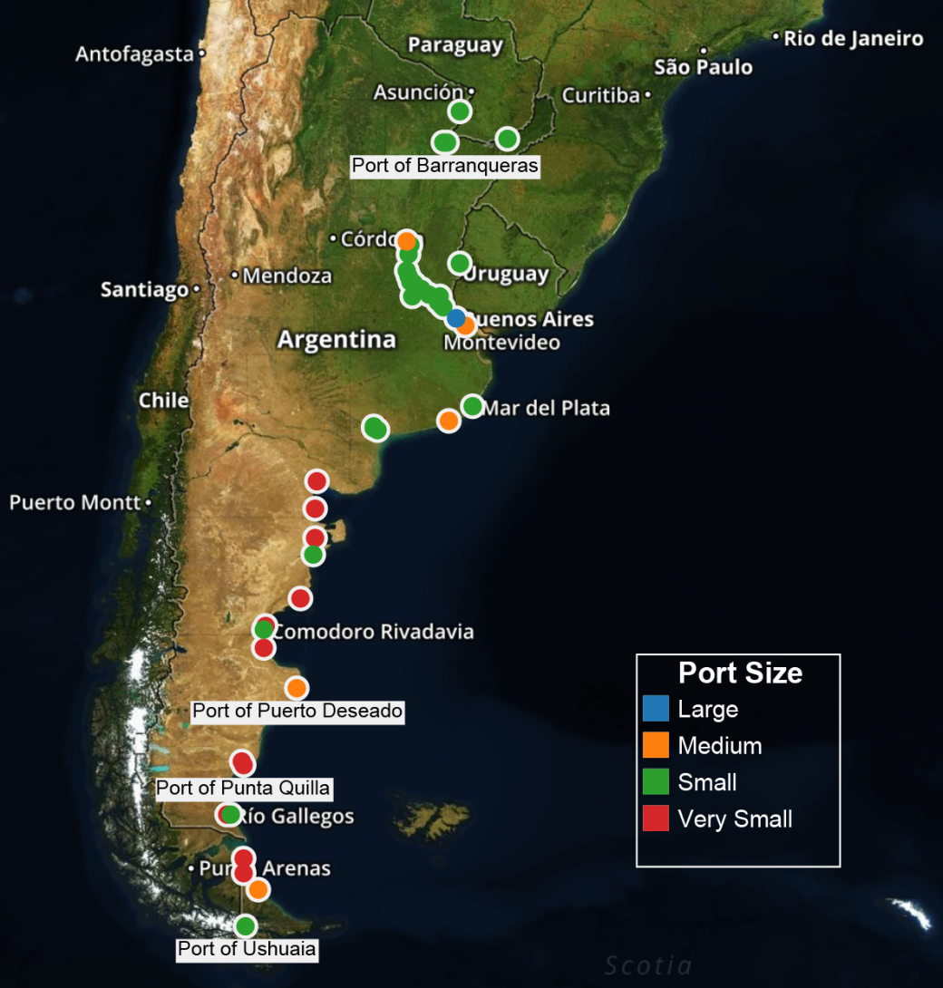
The map below shows all of the ports in Argentina. We have classified them based on their size and container traffic into the following classes: very small, small, medium and large. What becomes apparent when you look at this map is that most of Argentina’s ports are either very small or small. In fact, there are only two ports that can be classified as large ports – Port of Buenos Aires and Dock Sud Port. These two ports are geographically located next to each other on either side of what used to be Puerto Madero, the historical port of Buenos Aires. Also, it is evident where the main logistics clusters are located on or along the Rio de la Plata in Argentina. There are ports that are not located on the Rio de La Plata, but most of Argentina’s population and companies are located near the Rio de la Plata. We will take a closer look at the Rio de la Plata ports to demonstrate the concentration port infrastructure in this area of the country.
( Tableau data: Ports )
Buenos Aires and the Rio de la Plata
Below, we will provide a maps that shows the two main areas for Argentina’s cargo – the Rio de la Plata and Bahía Blanca regions. These maps show the cargo traffic density for these ports. Cargo traffic appears in three colors – red, green and blue. The red lines represent oil tankers, the green lines represent cargo ships and the blue lines represent passenger ships. You will only see passenger ship traffic on the map that shows the Rio de la Plata region. The maps also show red and green dots or arrows, these correspond with cargo ships and oil tankers that are currently in or have recently departed the port. Additionally, you will notice that there is a significant amount of traffic up stream on the Rio de la Plata. Many cities on the river have ports; however, none of them as large as the ports of Buenos Aires and Dock Sud.
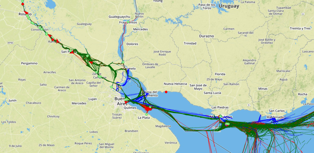
Shipping Routes of the River Plata
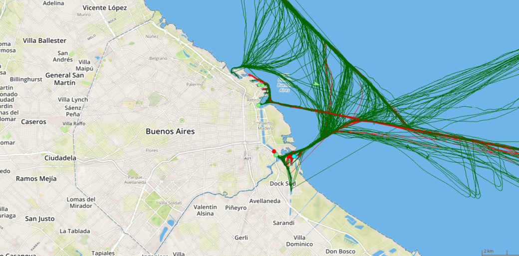
Buenos Aires and Dock Sud Port Traffic
The maps above and below show the ports of Buenos Aires and Dock Sud, two of the most biggest and busiest ports of Argentina. They have very close integrated network with road and rail. In this way, the containers coming in by freight can be easily transported to other parts of the nation by road or rail.
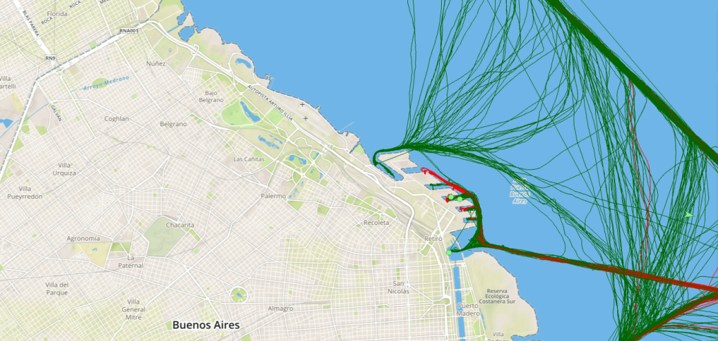
Port Integration with Rail and Air at the Port of Buenos Aires
The map below shows the ports of Ingeniero White and Baha Blanca. The majority of the ships coming in and exiting this port are oil tankers (marked in red in the map).
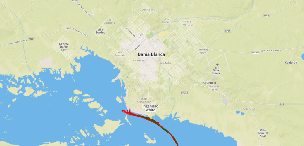
Port Traffic at Bahia Blanca and Ingeniero White Ports
Source:
